| 1 |
Sunday, March 9, 2025 |
Puerto Williams, Chile |
Embark |
9:00 PM |

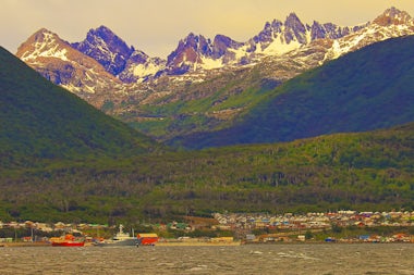
Puerto Williams is a Chilean port and naval base located on Isla Navarino facing the Beagle Channel. It lies 46 km E of Ushuaia on the opposite N side of the Chanel. With a population of a little over 2,000, including both naval personnel and civilians, Puerto Williams claims to be the southernmost city in the world (based on definition of ‘city’; its population is 2900). Read more about Puerto Williams, Chile
|
| 2 |
Monday, March 10, 2025 |
Drake Passage, Antarctica |
12:00 AM |
12:00 AM |

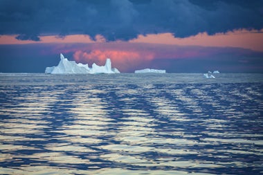
Drake Passage is the body of water between the southern tip of South America at Cape Horn and the South Shetland Islands of Antarctica. Named after the sixteenth century English explorer Sir Francis Drake, although he never actually sailed the passage, it connects the Pacific and Atlantic oceans, and is the shortest crossing from Antarctica to the rest of the world’s land, about 860 km. Conditions can change instantly in the Drake Passage, owing to strong winds, large waves, strong currents, and icebergs: hence notorious as ‘sailors’ graveyard.’
Until the opening of the Panama Canal in 1914 large ships had to sail this passage. Read more about Drake Passage, Antarctica
|
| 3 |
Tuesday, March 11, 2025 |
Drake Passage, Antarctica |
12:00 AM |
12:00 AM |

Drake Passage is the body of water between the southern tip of South America at Cape Horn and the South Shetland Islands of Antarctica. Named after the sixteenth century English explorer Sir Francis Drake, although he never actually sailed the passage, it connects the Pacific and Atlantic oceans, and is the shortest crossing from Antarctica to the rest of the world’s land, about 860 km. Conditions can change instantly in the Drake Passage, owing to strong winds, large waves, strong currents, and icebergs: hence notorious as ‘sailors’ graveyard.’
Until the opening of the Panama Canal in 1914 large ships had to sail this passage. Read more about Drake Passage, Antarctica
|
| 4 |
Wednesday, March 12, 2025 |
Hope Bay, Antarctica |
5:30 AM |
12:00 AM |

Hope Bay is located on Trinity Peninsula, the northern tip of the Antarctic Peninsula, 350 km north of the Antarctic Circle.This is the closest part of Antarctica to the South American mainland. Hope Bay is 5 km long and 3 km wide, and opens into Antarctic Sound, a short strait separating Trinity Peninsula from a number of offshore islands. Actually, Hope Bay is often unreachable due to pack ice from the Larsen Ice Shelf clogging Antarctic Strait. Read more about Hope Bay, Antarctica
|
| 5 |
Thursday, March 13, 2025 |
Antarctic Peninsula, Antarctica |
12:00 AM |
12:00 AM |

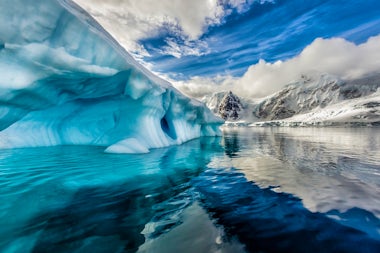
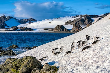
The Antarctic Peninsula is the northernmost part of the mainland of Antarctica, the top one third (650km) actually lying north of the Antarctic Circle. It includes numerous islands and connecting ice sheets that reach to within 1000 km of the southernmost tips of Chile and Argentina. The northern part of the peninsula in known as Graham Land, the southern half Palmer Land. Read more about Antarctic Peninsula, Antarctica
|
| 6 |
Friday, March 14, 2025 |
Antarctic Peninsula, Antarctica |
12:00 AM |
12:00 AM |

The Antarctic Peninsula is the northernmost part of the mainland of Antarctica, the top one third (650km) actually lying north of the Antarctic Circle. It includes numerous islands and connecting ice sheets that reach to within 1000 km of the southernmost tips of Chile and Argentina. The northern part of the peninsula in known as Graham Land, the southern half Palmer Land. Read more about Antarctic Peninsula, Antarctica
|
| 7 |
Saturday, March 15, 2025 |
Antarctic Peninsula, Antarctica |
12:00 AM |
12:00 AM |

The Antarctic Peninsula is the northernmost part of the mainland of Antarctica, the top one third (650km) actually lying north of the Antarctic Circle. It includes numerous islands and connecting ice sheets that reach to within 1000 km of the southernmost tips of Chile and Argentina. The northern part of the peninsula in known as Graham Land, the southern half Palmer Land. Read more about Antarctic Peninsula, Antarctica
|
| 8 |
Sunday, March 16, 2025 |
South Shetland Islands, Antarctica |
12:00 AM |
6:30 PM |

The South Shetland Islands is a group of 11 major and several minor islands located 960 km south of the tip of South America and about 120 km north of the Antarctic Peninsula. While discovered towards the beginning of the seventeenth century, either by Dutch or Spanish explorers, it is currently not administered by any one nation. There are 18 research stations on the islands (10 year-round, 8 summer only). Read more about South Shetland Islands, Antarctica
|
| 9 |
Monday, March 17, 2025 |
Drake Passage, Antarctica |
12:00 AM |
12:00 AM |

Drake Passage is the body of water between the southern tip of South America at Cape Horn and the South Shetland Islands of Antarctica. Named after the sixteenth century English explorer Sir Francis Drake, although he never actually sailed the passage, it connects the Pacific and Atlantic oceans, and is the shortest crossing from Antarctica to the rest of the world’s land, about 860 km. Conditions can change instantly in the Drake Passage, owing to strong winds, large waves, strong currents, and icebergs: hence notorious as ‘sailors’ graveyard.’
Until the opening of the Panama Canal in 1914 large ships had to sail this passage. Read more about Drake Passage, Antarctica
|
| 10 |
Tuesday, March 18, 2025 |
Drake Passage, Antarctica |
12:00 AM |
12:00 AM |

Drake Passage is the body of water between the southern tip of South America at Cape Horn and the South Shetland Islands of Antarctica. Named after the sixteenth century English explorer Sir Francis Drake, although he never actually sailed the passage, it connects the Pacific and Atlantic oceans, and is the shortest crossing from Antarctica to the rest of the world’s land, about 860 km. Conditions can change instantly in the Drake Passage, owing to strong winds, large waves, strong currents, and icebergs: hence notorious as ‘sailors’ graveyard.’
Until the opening of the Panama Canal in 1914 large ships had to sail this passage. Read more about Drake Passage, Antarctica
|
| 11 |
Wednesday, March 19, 2025 |
Ushuaia, Argentina |
8:00 AM |
9:00 PM |

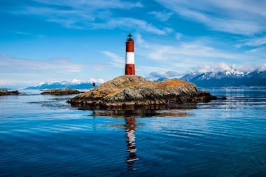
Ushuaia, the world's southernmost city, is located on the Beagle Channel, where soaring mountains, ice-blue glaciers, and an historic lighthouse create an ideal backdrop. The capital of the Argentine province of Tierra del Fuego, it was first settled by British missionaries. During the first half of the 20th C the major building of the city was a prison, built by the Argentinian government for repeat offenders and serious criminals, as the subpolar oceanic climate made escape difficult. Read more about Ushuaia, Argentina
|
| 12 |
Thursday, March 20, 2025 |
Baia Garibaldi, Chile |
7:30 AM |
12:00 PM |

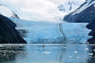
Bahia Garibaldi is a fjord that branches off the Noroeste arm of the Beagle Channel. The Beagle Channel is a strait in Tierra del Fuego Archipelago on the extreme southern tip of South America. between Chile and Argentina. Read more about Baia Garibaldi, Chile
|
| 13 |
Friday, March 21, 2025 |
Chilean Fjords, Chile |
12:00 AM |
12:00 AM |

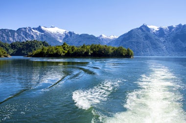
Strikingly rich in natural and historical attractions, the narrow fjords on the west coast of Chile penetrate deeply into the mountains of the Bernardo O'Higgins National Park, a major part of the Southern Patagonian Ice Field. This is the largest of the protected areas in Chile, and with no large rivers in the area the fjords drain water from outlet glaciers of the ice-capped, storm-swept elevations. It is a large area of uninhabited islands, deep sounds, breathtaking glaciers, and narrow passages. Read more about Chilean Fjords, Chile
|
| 14 |
Saturday, March 22, 2025 |
Montanas Fjord |
|
|
| 15 |
Sunday, March 23, 2025 |
Chilean Fjords, Chile |
12:00 AM |
12:00 AM |

Strikingly rich in natural and historical attractions, the narrow fjords on the west coast of Chile penetrate deeply into the mountains of the Bernardo O'Higgins National Park, a major part of the Southern Patagonian Ice Field. This is the largest of the protected areas in Chile, and with no large rivers in the area the fjords drain water from outlet glaciers of the ice-capped, storm-swept elevations. It is a large area of uninhabited islands, deep sounds, breathtaking glaciers, and narrow passages. Read more about Chilean Fjords, Chile
|
| 16 |
Monday, March 24, 2025 |
Chilean Fjords, Chile |
12:00 AM |
12:00 AM |

Strikingly rich in natural and historical attractions, the narrow fjords on the west coast of Chile penetrate deeply into the mountains of the Bernardo O'Higgins National Park, a major part of the Southern Patagonian Ice Field. This is the largest of the protected areas in Chile, and with no large rivers in the area the fjords drain water from outlet glaciers of the ice-capped, storm-swept elevations. It is a large area of uninhabited islands, deep sounds, breathtaking glaciers, and narrow passages. Read more about Chilean Fjords, Chile
|
| 17 |
Tuesday, March 25, 2025 |
Chilean Fjords, Chile |
12:00 AM |
12:00 AM |

Strikingly rich in natural and historical attractions, the narrow fjords on the west coast of Chile penetrate deeply into the mountains of the Bernardo O'Higgins National Park, a major part of the Southern Patagonian Ice Field. This is the largest of the protected areas in Chile, and with no large rivers in the area the fjords drain water from outlet glaciers of the ice-capped, storm-swept elevations. It is a large area of uninhabited islands, deep sounds, breathtaking glaciers, and narrow passages. Read more about Chilean Fjords, Chile
|
| 18 |
Wednesday, March 26, 2025 |
Tortel, Chile |
6:30 AM |
5:00 PM |

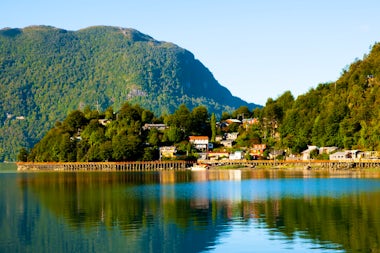
Caleta Tortel is a coastal village in Chile. It is the administrative centre of the commune of Tortel and is located between the mouth of the Baker River - the largest river in Chile - and a small bay in the Baker Channel. The surrounding geography is rugged, formed by a number of islands, fjords, channels and estuaries. Read more about Tortel, Chile
|
| 19 |
Thursday, March 27, 2025 |
Day At Sea |
|
|
| 20 |
Friday, March 28, 2025 |
Castro, Chile |
6:30 AM |
5:00 PM |

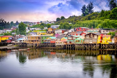
Castro, situated on the east coast of Chiloe Island, sits on a bluff above its sheltered estuary and is the capital of the Chiloe Archipelago, in Chile. Castro is famous for its brightly painted traditional wooden stilt houses, so the greatest single attraction is simply walking down the streets and around the central Plaza de Armas. With its well-kept park that is surrounded by many shops and restaurants, it presents a great opportunity to absorb the local culture. Read more about Castro, Chile
|
| 21 |
Saturday, March 29, 2025 |
Niebla, Chile |
1:00 PM |
6:30 PM |

Niebla, a coastal Chilean town, is located on the northern shore of the mouth of the Valdivia River across from Corral in the Los Lagos Region. Niebla is Valdivia’s – the local commune – most important resort. It is 15km from the city on the road to the mouth of the Valdivia River. Read more about Niebla, Chile
|
| 22 |
Sunday, March 30, 2025 |
Day At Sea |
|
|
| 23 |
Monday, March 31, 2025 |
Santiago (Valparaiso), Chile |
7:00 AM |
Disembark |

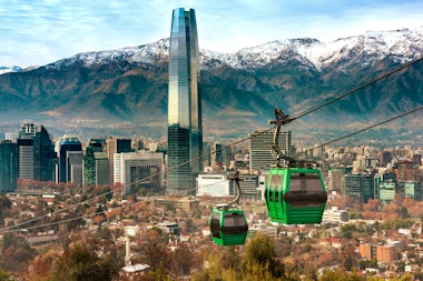
Santiago is the capital of Chile, 90 minutes drive from its port Valparaiso. Santiago has easy access both to ski slopes just 50 km to the Andes, and beaches 100 km to the Pacific. Chile's steady economic growth has transformed Santiago into one of Latin America's most modern metropolitan areas, with dozens of shopping centers and impressive high-rises. Read more about Santiago (Valparaiso), Chile
|







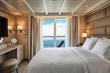



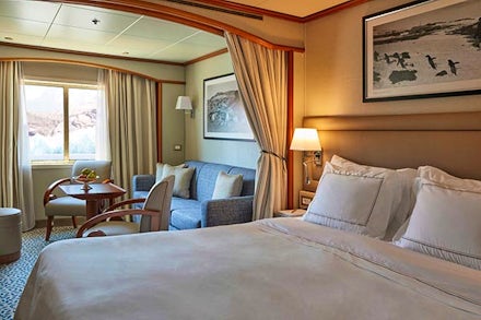
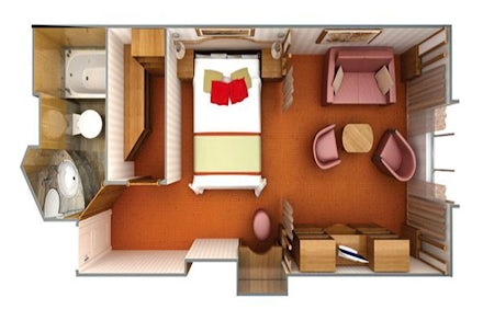
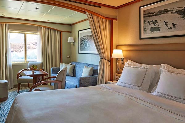
 3rd guest Capacity
 Bathtub & separate shower
 Bathtub/shower Combination
 fixed Queen beds
 Handicap suites
  Connecting Staterooms